Mapping
-
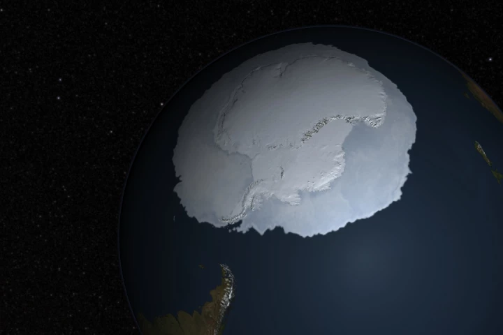 The British Antarctic Survey (BAS) has released the most detailed map yet of what Antarctica looks like when you strip away its ubiquitous cover of ice and snow. Derived from 60 years of data, it will help scientists understand ice flows better.
 -
 A new AI-based system allows coral reefs to be 3D-mapped faster and easier than ever before. It could prove integral to saving threatened reefs, by letting scientists study them both onsite and at their computers in their labs.
 -
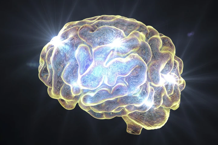 Researchers have revealed how regular ketamine use produces divergent changes in parts of the brain that produce the ‘feel-good’ neurotransmitter, dopamine. The discovery could have significant implications for the treatment of mental illness.
 -
 A new study has examined brain maps of people with mental illness and found that despite individual differences, common brain areas are affected. Researchers say this information may be useful for developing targeted treatments for different disorders.
 -
 Using old insurance maps, researchers enabled a machine-learning system to create 3D models of neighborhoods that no longer exist. The technique could lead to VR tours of the 'hoods, as well as provide data on the various impacts of urbanization.
 -
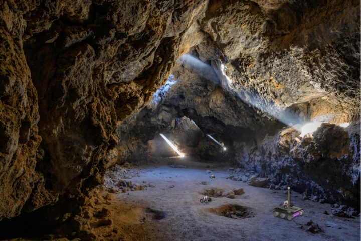 Exploring an unmapped cave system is a daunting enough prospect on its own, but think how risky it would be to do so on another planet such as Mars. That's why a new system is in the works, which would use "breadcrumb"-dropping rovers to do the job.
 -
 An international team of scientists and cartographers has released the most detailed map of the seafloor of the Southern Ocean that surrounds Antarctica. It covers 48 million km² and includes the deepest spot yet found in the region.
 -
 When it comes to making city maps based on aerial photos, manually tracing all the roads can be quite the hassle. As a result, we're now seeing computer programs that do so automatically. Scientists at MIT have developed a program of their own, that is promised to be even better at the job.
 -
 Combining elevation data gathered by the Lunar Reconnaissance Orbiter with Earth topography data, NASA researchers have produced the most accurate map ever created for the path of totality of the total solar eclipse that will be seen across a large swath of the United States later this year.
 -
 Astronomers say they've made the most precise measurements to date of dark energy, while pinpointing the positions of 1.2 million galaxies in the largest ever 3D map of the universe. The map covers over a quarter of the sky, spanning a volume of 650 cubic billion light years.
 -
 Using data captured by NASA's MErcury Surface, Space ENvironment, GEochemistry, and Ranging (MESSENGER) spacecraft, a team of scientists has constructed the first complete digital elevation model (DEM) of the planet Mercury.
 -
 Britain's Ordnance Survey (OS) has released its first map of Mars to examine the potential of the agency's advanced cartographic methods in creating detailed, easy to understand maps for planning future missions to the Red Planet.
Load More